Overview
Locating subsurface water ice on Mars is a critical step for future human exploration and resource utilization. Recent experiments using drone-mounted ground-penetrating radar (GPR) over Earth's glaciers have demonstrated that this technique can map buried ice with remarkable precision. By adapting these methods, spacecraft equipped with similar radars could pinpoint drilling sites on Mars where water ice lies just beneath the surface. This guide walks you through the principles, prerequisites, and practical steps to understand and potentially replicate this technology for Martian exploration.

Prerequisites
Basic Knowledge
- Radar Fundamentals: Understanding of electromagnetic wave propagation, reflection, and attenuation in different media.
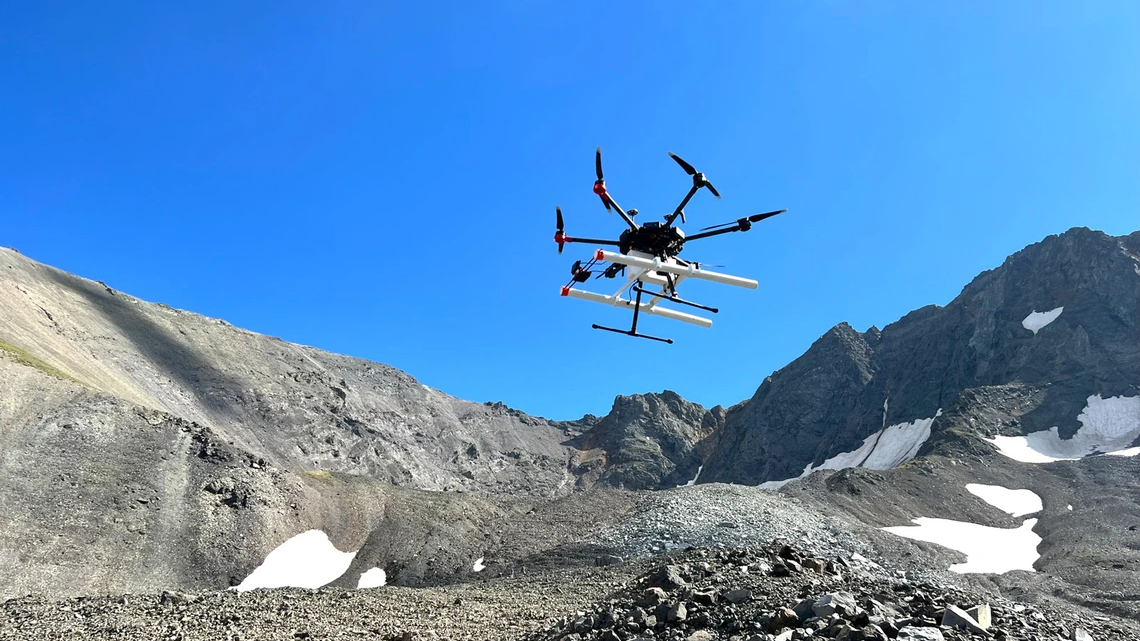
- Drone Operations: Familiarity with multirotor or fixed-wing drones, flight planning, and payload integration.
- Geological Context: Knowledge of glacial ice structures and Martian permafrost analogs.
Equipment & Software
- Radar System: Lightweight GPR (e.g., 200–900 MHz frequencies) suitable for drone mounting.
- Drone Platform: Able to carry payload (typically 1–5 kg) with stable flight for 30+ minutes.
- Processing Tools: Python with libraries like NumPy, SciPy, and GDAL; or MATLAB with Radar Toolbox.
- Field Data: Example data from known glaciers (e.g., Greenland or Alpine ice caps) for training.
Step-by-Step Instructions
1. Plan the Survey Area
Select a region on Earth that mimics Martian conditions — ideally a cold glacier with layered ice and debris. Use satellite imagery to identify flat, safe zones for drone flights. Define a grid of parallel flight lines spaced 5–10 meters apart to ensure adequate overlap for 3D reconstruction.
2. Configure the Radar System
Set the GPR to a center frequency that balances penetration depth and resolution. For ice mapping, 200–400 MHz offers 10–20 meters depth with ~0.5 m vertical resolution. Attach antennas rigidly to the drone’s underside to reduce vibration noise. Connect to a GPS/IMU unit for geolocation.
3. Pre-Flight Checks
- Calibrate the radar by measuring a known reflector (e.g., metal plate) at a known distance.
- Verify drone battery capacity — factor in 20% reserves for wind and cooling.
- Check for radio interference from nearby sources (cell towers, weather radar).
4. Execute the Drone Flight
Launch the drone at a constant altitude (e.g., 20–40 m above ground). Maintain a steady speed of 5–8 m/s to avoid motion blur in radar traces. The radar emits pulses at intervals, recording two-way travel time and amplitude. Typical flight lines cover 0.5–2 km each. Collect data in SEG-Y or custom binary format.
5. Process Raw Radar Data
- Preprocessing: Remove low-frequency noise using a high-pass filter (cutoff ~50 MHz). Apply a gain function (e.g., automatic gain control) to compensate for signal attenuation.
- Migration: Use a Kirchhoff or phase-shift migration to collapse hyperbolic reflections back to point sources, improving lateral resolution.
- Topographic Correction: Apply GPS elevation data to flatten the radargram to a constant datum.
Example Python snippet for a basic processing step:
import numpy as np
from scipy.signal import butter, filtfilt

# Sample data: radargram matrix (time_samples x traces)
def highpass_filter(data, cutoff_hz, sample_rate_hz, order=4):
    nyquist = 0.5 * sample_rate_hz
    normal_cutoff = cutoff_hz / nyquist
    b, a = butter(order, normal_cutoff, btype='high', analog=False)
    return filtfilt(b, a, data, axis=0)
6. Identify Buried Ice Signatures
Look for strong, continuous reflections with characteristic hyperbolic shapes. Ice typically exhibits a lower dielectric constant (ε≈3.2) than rock or soil, producing a distinct velocity pull-up. Use velocity analysis tools to calculate depth: z = v * t / 2 where v is wave speed in the medium (v = c / √ε). In icy areas, wave speed is about 0.168 m/ns.
7. Create Subsurface Maps
Interpolate the picked reflection horizons across all flight lines to generate a 3D volume. Use kriging or inverse distance weighting. Visualize with isosurfaces or depth slices. Mark potential drill targets where ice is shallow (<5 m depth) and layer thickness >2 m.
Common Mistakes
Ignoring Antenna Directivity
Drone-mounted antennas can tilt during turns, causing signal dropout. Always fly straight lines and use dual-polarized antennas to reduce angular dependence.
Misidentifying Airborne Noise
Vibrations from drone motors appear as low-amplitude periodic noise. Use notch filters at the rotor RPS frequency (e.g., 120 Hz for 7200 RPM).
Overinterpreting Hyperbolas
Not all hyperbolas are ice — boulders, void cavities, or even changes in soil moisture can mimic reflections. Correlate with seismic or electromagnetic independent measurements.
Underestimating Data Volume
Raw radar data can exceed 100 GB per day. Plan storage and use lossless compression (e.g., Lempel-Ziv) during acquisition.
Summary
Drone-based ground-penetrating radar offers a proven, cost-effective method to map buried ice in fine detail, directly transferable to Mars. By systematically planning surveys, configuring radar parameters, executing stable flights, and processing the data with appropriate filters and migration, you can locate water ice deposits suitable for future drilling. The technique highlights how Earth analog studies accelerate space exploration. With continued miniaturization, a similar system could fly on a Martian helicopter, providing unparalleled subsurface intelligence for future missions.